

Estimating the Water Depth
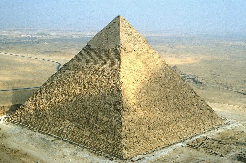
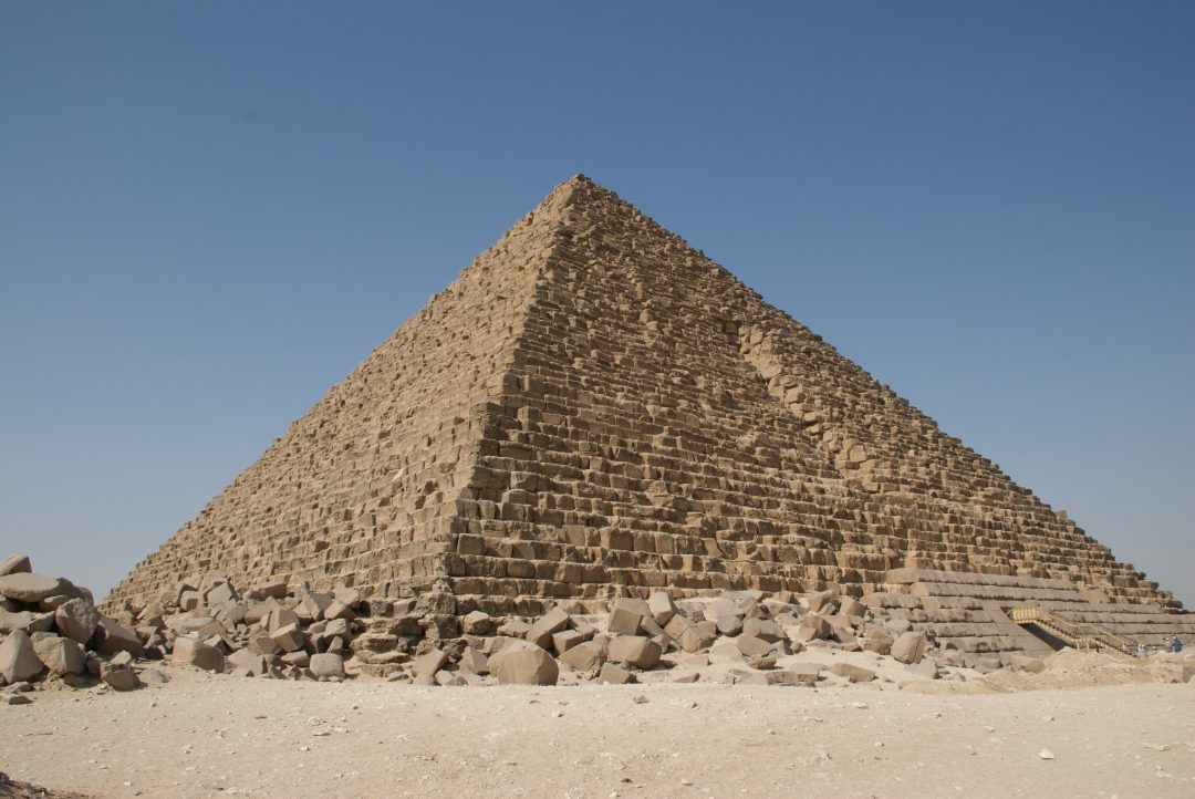
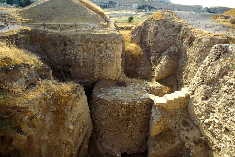
In Ethical Skeptics article “Hidden in Plain Sight,” published on December 18, 2023, He advances a provocative flood hypothesis. It states the Giza pyramids were submerged under saltwater for 50 to 400 years due to an oceanic displacement. Triggered by what he calls the Exothermic Core-Mantle Decoupling (Dzhanibekov Oscillation ECDO). He points to the Menkaure Pyramid’s casing stones as marking a ridgeline near the water’s surface. Which he says contrasts with the Khafre Pyramid’s more pronounced erosion from deeper submersion. While this theory seeks to reinterpret the pyramids’ physical condition, it encounters significant obstacles when examined against geological, archaeological, and chronological evidence.

Scale of the Proposed Flood
The Giza Plateau’s elevation provides a baseline for evaluating this claim. The Menkaure Pyramid’s base sits approximately 60 meters above current sea level, with a height of 65 meters. If its casing stones indicate a waterline (perhaps 5 to 10 meters up the structure) the water depth would need to reach 60 to 70 meters above modern sea level to affect its lower courses. For the Khafre Pyramid, which rises 143 meters from a similar base, the observed erosion on its lower 20 to 30 meters of casing suggests a depth of 80 to 90 meters. This range, 60 to 90 meters, represents the water level required to support the hypothesis of submersion and erosion at these monuments.
Evaluating the Physical Flood Evidence
The theory rests on the condition of the pyramids’ casing stones. The Tura limestone of the Khafre Pyramid, with a Mohs hardness of 4, exhibits pitting and irregular wear. Which the author attributes to prolonged saltwater exposure. However, these features are consistent with natural desert processes. Over 4,500 years, wind laden with sand, combined with infrequent rainfall and thermal cycling, can erode soft limestone without requiring submersion. The “wave action” notches on Khafre’s southern face, cited as evidence of water impact, may instead reflect differential weathering or construction techniques, as wind often shapes exposed surfaces unevenly over time.
Salt encrustation on the lower stones is presented as further proof of submersion. Yet, this can be explained by a well-documented process in arid regions: saline groundwater rises through capillary action in porous limestone, depositing sodium chloride upon evaporation. Geological surveys of the Giza Plateau confirm this mechanism, eliminating the need for an oceanic origin. The Menkaure Pyramid’s lesser erosion, interpreted as evidence of partial submersion, aligns with its smaller scale, fewer preserved casing stones, or reduced exposure to prevailing winds, rather than a precise waterline.
Assessing the ECDO Mechanism
The ECDO hypothesis suggests that a decoupling of Earth’s core and mantle induced a rotational instability. Akin to the Dzhanibekov Effect observed in spinning rigid bodies, causing oceans to flood Giza. However, Earth’s complex structure, a liquid outer core, solid inner core, and viscous mantle. Maintains rotational stability through its mass distribution and angular momentum. Geophysical research offers no evidence of a rapid, reversible shift capable of elevating sea levels by 60 to 90 meters. Furthermore, while limestone blocks at Giza contain fossilized seashells from their Eocene formation (circa 56-34 million years ago), indicating an ancient marine origin. No surface marine deposits, such as shells, sand, or coral, from a recent flood appear on or between the stones. The absence of such post-construction markers, expected from a 50-400 year submersion, undermines the notion of an oceanic inundation. Contrasting sharply with the prehistoric shells embedded within the rock itself.
Flood Implications for Other Ancient Sites
A flood of 60 to 90 meters would submerge numerous ancient landmarks. Yet their archaeological and geological records do not support this scenario.
Ancient Mesopotamia
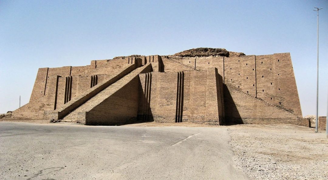
Ur, Mesopotamia: With an elevation of 15 meters, Ur would be submerged by 45 to 75 meters. Dating to the Early Bronze Age (circa 2600 BCE), its ziggurat and royal tombs reflect uninterrupted occupation. With silt layers from local Euphrates floods (circa 2500 BCE) but no oceanic sediment or disruption indicative of a centuries-long global inundation.
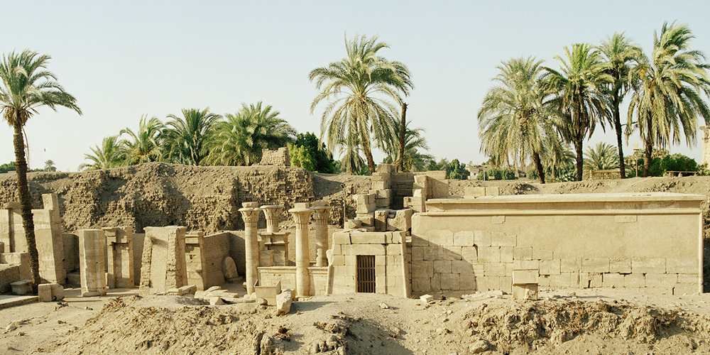
Ancient Egypt
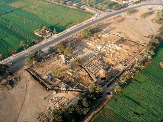
Memphis, Egypt: At 20 meters elevation, Memphis would lie 40 to 70 meters underwater. As the capital of Egypt’s Old Kingdom (circa 2686-2181 BCE), it hosted continuous activity, evidenced by the construction of the Ptah Temple and administrative complexes during the pyramid-building era. Excavations reveal no marine deposits or interruptions consistent with a flood of this duration. Only minor river silt layers unrelated to oceanic submersion.
Jordan valley
Jericho: At 258 meters below sea level, the Jordan Valley would flood, though higher terraces (~200 meters below sea level) might remain above water. Occupied since the Neolithic period (circa 8000 BCE), Jericho’s stone tower and subsequent Bronze Age layers (circa 3000-2000 BCE) show no trace of a mid-Holocene oceanic flood. Only localized wadi flooding consistent with its arid setting.
Nile Delta
Nile Delta: Averaging below 10 meters elevation, this region would be submerged by 50 to 80 meters. During the Old Kingdom (circa 2630-2181 BCE), it supported extensive agriculture and settlement. As evidenced by archaeological finds like pottery and farming tools from sites such as Merimde Beni. No marine strata or abandonment horizons from this period suggest a prolonged flood.
The is an absence of marine geological signatures, sedimentary layers, saltwater fauna, or coastal erosion patterns, at these sites. All active during or shortly after the pyramid era, undermines the feasibility of a 60–90-meter flood.
Conclusion
The Ethical Skeptic’s theory hinges on the Menkaure Pyramid’s casing stones as evidence of a waterline from a 60–90-meter flood. Driven by an ECDO-induced oceanic surge. However, the required depth and global scale lack geological corroboration, as Giza and other sites bear no marine traces. The pyramids’ erosion and salt deposits align with desert weathering over 4,500 years. Not centuries of submersion, and the ECDO mechanism contradicts known geophysical principles. The uninterrupted occupation of contemporary landmarks like Memphis and Ur, along with the physical record of the Giza pyramids, reflects a story of time and arid conditions, not a submerged past.
Come back to AncientHistoryX for the unvarnished truth.