

This article critically evaluates the capabilities and limitations of Synthetic Aperture Radar (SAR) Doppler Tomography, specifically using data from the COSMO-SkyMed satellite constellation, in producing 2D cross-sectional images penetrating the Earth’s subsurface to depths of tens or hundreds of meters.
The focus is on claims by HarmonicSAR, led by Filippo Biondi, asserting that this technology, combined with surface seismic shift analysis, can image deep structures, such as the Gran-Sasso Physics Laboratory at 1.4 km depth or extensive underground complexes beneath the Giza plateau at depths up to 648 meters.
Synthetic Aperture Radar (SAR) with COSMO-SkyMed: Capabilities and Limitations

Overview
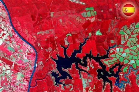
SAR is an active remote sensing technology that emits microwave pulses to create high-resolution images of the Earth’s surface. COSMO-SkyMed, operated by the Italian Space Agency (ASI), consists of four satellites with X-band SAR sensors (wavelength ~3 cm), orbiting at approximately 619 km altitude. These satellites provide imaging modes like Spotlight, Stripmap, and ScanSAR, optimized for surface monitoring with resolutions down to 1 meter in Spotlight mode.
Capabilities:
- Surface Imaging: SAR generates detailed 2D surface maps, unaffected by weather or daylight, making it valuable for terrain mapping, infrastructure monitoring, and environmental studies.
- Shallow Subsurface Penetration: In dry, non-conductive environments (e.g., desert sand), SAR can penetrate a few centimeters to about 1 meter with X-band, or up to a few meters with lower frequencies like L-band (~23 cm wavelength). For example, L-band SAR has mapped paleochannels up to 2.84 meters deep in deserts.
- Interferometry (InSAR): By analyzing phase differences between SAR images over time, InSAR detects surface deformations with millimeter precision, useful for tracking subsidence or seismic effects
Limitations:
- Penetration Depth: Microwave signals are absorbed and scattered by soil, rock, and water, limiting penetration to shallow depths. X-band SAR, as used by COSMO-SkyMed, typically penetrates less than a meter in rock or moist soil, with studies showing depths of 0-25 cm for L-band in dry conditions (MDPI, 2022).
- Frequency Constraints: Lower frequencies (e.g., P-band, ~75 cm) offer slightly deeper penetration but are impractical for space-based systems due to large antenna sizes and ionospheric interference, and even then, depths rarely exceed a few meters.
- No Direct Cross-Sections: SAR produces plan-view maps or surface deformation data, not direct 2D cross-sectional images of the subsurface, requiring alternative methods for depth profiling.
SAR Doppler Tomography: Capabilities and Limitations
Overview
SAR Doppler Tomography, as developed by HarmonicSAR, integrates Doppler shift analysis, frequency changes due to relative motion, into SAR processing to infer internal structures from surface vibrations. Using COSMO-SkyMed data, this method analyzes micro-movements (MM) caused by seismic waves, environmental noise, or human activity, aiming to extrapolate subsurface features. HarmonicSAR claims this can detect structures kilometers below the surface.
Capabilities:
- Surface Vibration Analysis: By processing Doppler shifts in SAR signals, it detects surface vibrations with high sensitivity, potentially inferring shallow subsurface features. Their 2022 study on the Great Pyramid of Giza used COSMO-SkyMed’s Spotlight mode to map internal chambers within the pyramid’s 146-meter height (Malanga & Biondi, 2022).
- Multi-Satellite Advantage: COSMO-SkyMed’s four satellites (e.g., CSG-1 and CSG-2 operational by 2025) allow data collection from multiple angles or times, enhancing InSAR or tomographic resolution, though not penetration depth.
- Applications: Claimed uses include mapping archaeological sites, tunnels, and infrastructure, leveraging surface motion to suggest underlying voids or structures.
Limitations:
- Penetration Depth: SAR Doppler Tomography does not directly penetrate the subsurface; it infers structures from surface vibrations. The depth of inference is limited to where vibrations remain detectable, typically a few meters in rock, not tens or hundreds. Microwave penetration remains constrained to centimeters to meters, as per standard studies.
- Indirect Extrapolation: The method relies on interpreting surface seismic shifts, not imaging subsurface signals directly. Extrapolating to depths like 1.4 km or 648 meters assumes vibrations propagate and remain distinguishable through dense rock, which lacks scientific support for SAR-based systems.
- Accuracy and Resolution: Deeper extrapolations suffer from reduced resolution and increased uncertainty, as vibration signals weaken and scatter, making precise deep imaging unreliable.
HarmonicSAR’s Claim: Surface Seismic Shifts and 2D Depth Scans
Claim Description:
HarmonicSAR asserts that SAR Doppler Tomography, using COSMO-SkyMed data, combines surface seismic shift analysis with SAR to extrapolate 2D depth scans. They claim this reveals structures like the Gran-Sasso Physics Laboratory at 1.4 km depth and underground complexes beneath Giza, including wells descending 648 meters under the Khafre Pyramid (HarmonicSAR, 2025). Their patent application (PCT/EP2023/064345, filed May 29, 2023) supports this methodology.
Scientific Evaluation:
- Surface Seismic Shifts: Seismic shifts—ground vibrations from natural or human sources—can be detected by SAR via Doppler analysis or InSAR, measuring surface displacements with high precision. However, these shifts provide surface data, not direct subsurface penetration. HarmonicSAR’s approach likely uses these vibrations to infer deeper structures, similar to seismic reflection principles, but SAR lacks the wave propagation depth of seismic methods.
- Extrapolation Mechanism: Their technique involves analyzing vibration patterns (e.g., via Multi-Chromatic Analysis) to model subsurface features. For shallow depths (e.g., within a pyramid’s height), this might correlate surface motion to known voids. However, extrapolating to hundreds or thousands of meters requires seismic waves to travel deep, reflect, and return detectable signals to the surface—feasible with ground-based seismology, not satellite-based SAR.
- Limitations of SAR: SAR’s X-band microwaves cannot penetrate beyond a meter in rock, and even in dry sand, L-band limits are a few meters. The claim hinges on seismic vibrations being captured by SAR, but the satellite’s altitude (~619 km) and microwave nature limit sensitivity to shallow effects. Deep seismic imaging requires low-frequency sound waves (Hz range), not microwaves (GHz range), and ground-based receivers, not space-based sensors.
- Feasibility Assessment: Extrapolating 2D depth scans to tens or hundreds of meters is implausible with SAR Doppler Tomography. Studies show seismic wave detection by SAR is surface-focused (e.g., earthquake-induced shifts), not capable of resolving kilometer-deep structures with metric precision (Nature, 2009).
Color Scans Explained
Nature of the Scans:
The color scans provided by HarmonicSAR for Giza, particularly under Khafre, are visualizations of inferred subsurface structures based on surface seismic shift analysis. These are not direct 2D cross-sections but interpretive maps derived from Doppler shift data. Colors (e.g., red for high vibration, blue for low) likely represent vibration intensity or modeled features, suggesting voids or chambers. For instance, claims of 648-meter wells are extrapolations from shallow vibration patterns, not direct measurements.
Scientific Basis:
Their 2022 Giza study demonstrated this method within the Great Pyramid’s 146-meter height. Where surface vibrations plausibly could correlate to known chambers. Extending this to 648 meters or 1.4 km lacks empirical support. SAR cannot detect deep seismic reflections, and the extrapolation overestimates the method’s capability. These scans are artistic or speculative representations, not validated by ground-truth data like seismic surveys or excavations.
Comparative Technologies for Deep Imaging
Ground Penetrating Radar (GPR):
- Capability: Images up to tens of meters in dry conditions using low-frequency radar, producing 2D/3D cross-sections.
- Limitation: Requires ground proximity, not satellite-based.
Seismic Tomography:
- Capability: Uses low-frequency sound waves to image hundreds to thousands of meters, standard for deep geological mapping.
- Limitation: Ground-based, not feasible from satellites.
Comparison Table:
| Technology | Type | Penetration Depth | Output | Satellite-Based? |
| SAR (COSMO-SkyMed) | Active Radar | Few cm to ~1 m | 2D surface maps, shallow subsurface | Yes |
| SAR Doppler Tomography | Active Radar (Indirect) | Few cm to meters | Inferred maps, shallow subsurface | Yes |
| Ground Penetrating Radar (GPR) | Active Radar | Up to tens of meters | 2D/3D cross-sections | No |
| Seismic Tomography | Active Seismic | Hundreds to thousands of meters | 2D/3D cross-sections | No |
Proof of Inability for Deep Imaging
- Penetration Evidence: SAR’s X-band penetration is limited to less than a meter in rock, with L-band reaching a few meters in dry sand (MDPI, 2022). Extrapolating seismic shifts cannot overcome this, as SAR detects surface effects, not deep reflections.
- Seismic vs. SAR: Seismic tomography uses sound waves penetrating kilometers, detected by ground sensors, while SAR’s microwaves are surface-bound. HarmonicSAR’s method lacks the physics to bridge this gap.
- Validation Gap: Claims of 1.4 km or 648 meters lack peer-reviewed confirmation beyond HarmonicSAR’s own studies, contrasting with established seismic methods.
Conclusion
SAR Doppler Tomography with COSMO-SkyMed data, even when combined with surface seismic shift analysis, cannot produce direct or reliably extrapolated 2D cross-sectional images penetrating tens or hundreds of meters into the Earth. HarmonicSAR’s claims of kilometer-deep imaging are scientifically implausible, as SAR penetration is limited to shallow depths, and their extrapolation from surface vibrations overestimates the technology’s reach. The color scans are interpretive visualizations, not direct measurements, and remain unverified for deep structures. For true deep imaging, ground-based seismic tomography is required.
Key Sources
- HarmonicSAR Website (www.harmonicsar.com)
- MDPI: Estimate Penetration Depth of L- and S-Band SAR Signals (2022)
- NASA Earthdata: SAR Overview
- USGS: Ground Penetrating Radar and Seismic Tomography
- ASI: COSMO-SkyMed Technical Specifications
- Nature: “Using seismic waves to image Earth’s internal structure” (2009)