
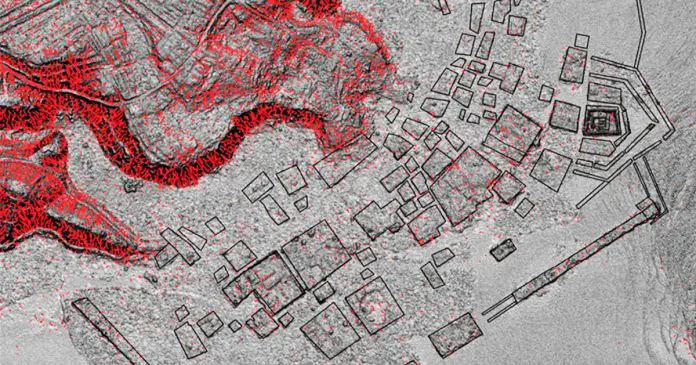
An airborne LiDAR survey completed in March 2019 mapped Nan Madol and the neighboring volcanic island of Temwen on Pohnpei in the Federated States of Micronesia. The scan covered 8.69 square kilometers and produced more than 108 million returns, which researchers processed into bare-earth terrain models. These models exposed a dense network of earthen berms, low wet basins, and connecting channels that covers much of Temwen. Field teams later confirmed the features on the ground. The system represents the first intensive irrigated cultivation landscape documented in the Central and Eastern Caroline Islands. Its scale and organization match the labor required to construct Nan Madol’s roughly 100 artificial islets of basalt and coral, which served as the seat of the Saudeleur Dynasty from about 1200 to 1600 CE.
The LiDAR Survey and Terrain Models
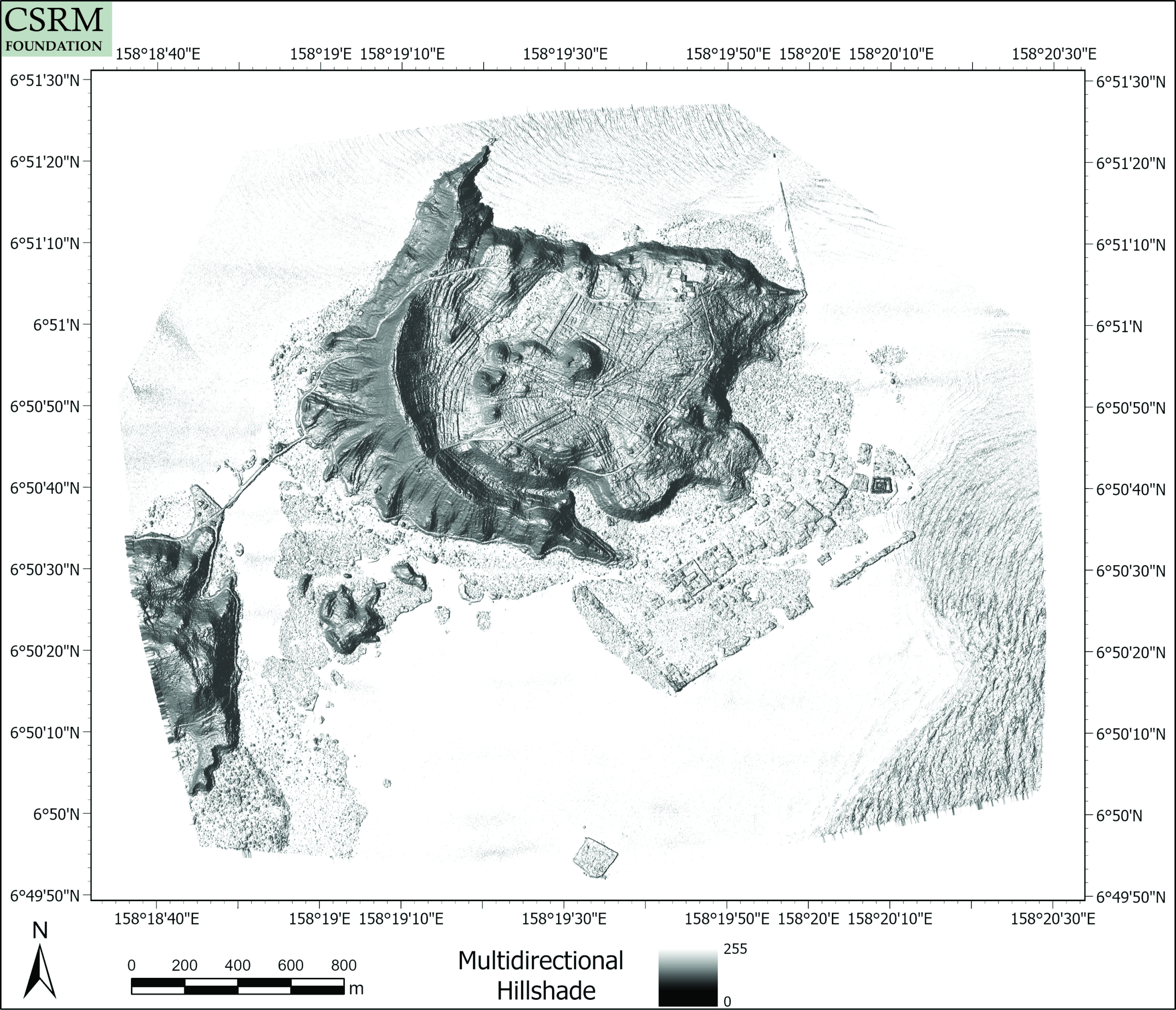
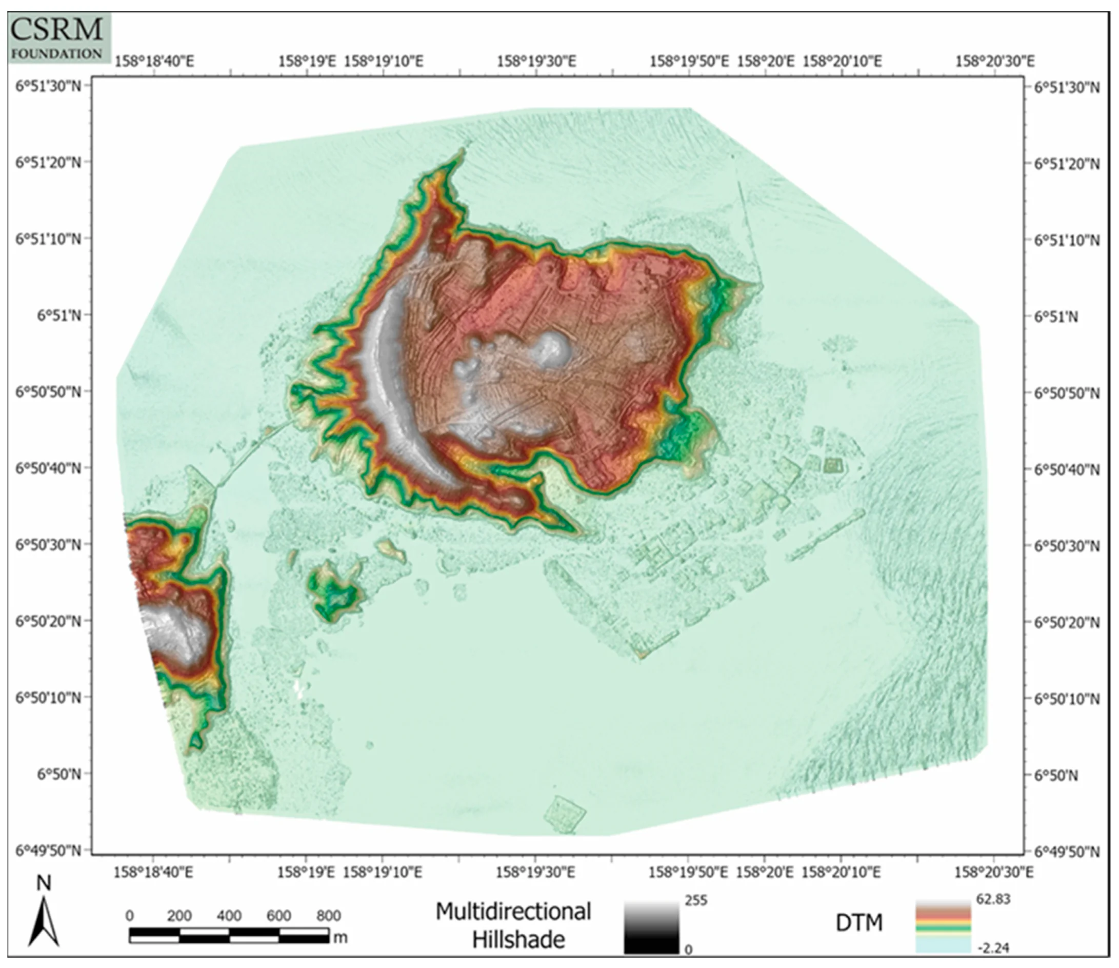
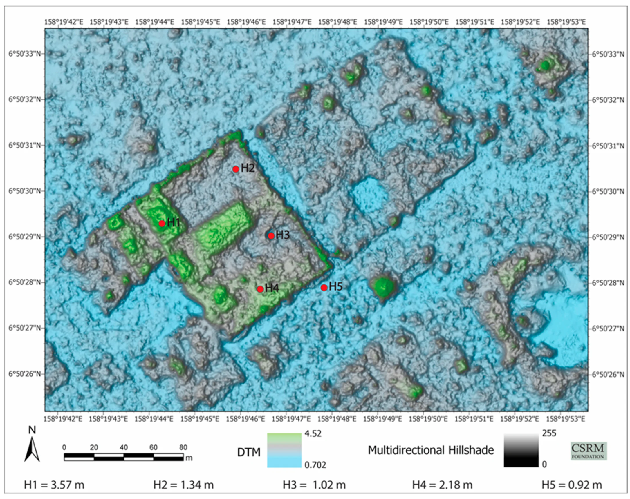
Aerial Surveying Inc. flew a Britten-Norman Islander equipped with a full-waveform ALIS560 sensor at a mean altitude of 457 meters. The resulting point cloud was classified into ground and non-ground returns, yielding a digital terrain model with 0.5-meter cells. Multidirectional hillshades, sky-view factor images, and composite shaded-relief products revealed subtle linear and rectangular patterns that ordinary aerial photographs and satellite imagery had obscured under dense vegetation. Flow-direction and flow-accumulation rasters further showed how the engineered features redirect surface water across the island. Canopy-height models derived from first and last returns separately mapped vegetation that threatens both the archaeological features and the modern canals of Nan Madol.
Characteristics of the Cultivation Features
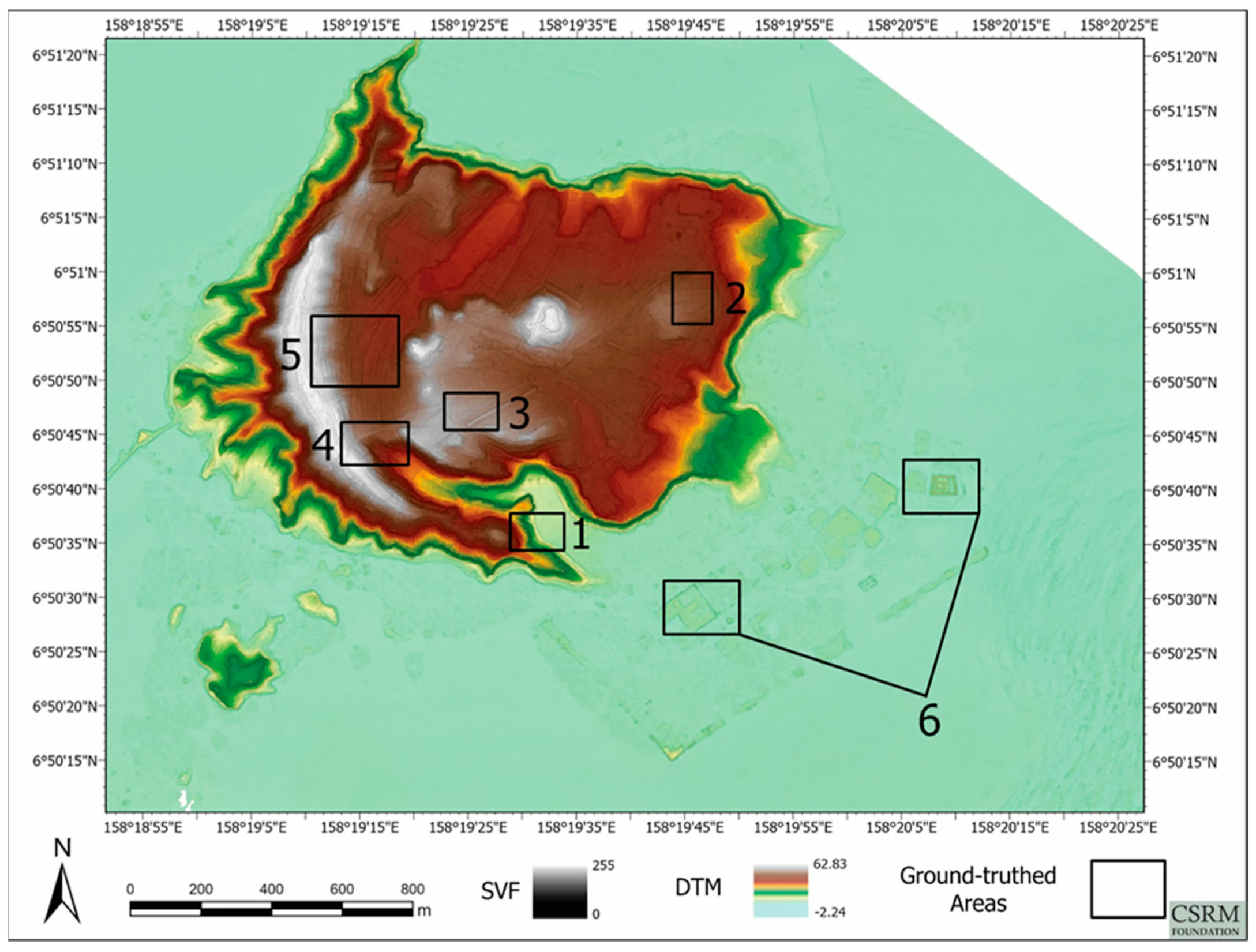
Ground inspection of six priority areas confirmed low, rectangular basins separated by earthen berms that rise 0.5 to 1.25 meters at their crests. Channels cut through the berms and continue downslope, allowing water to move from higher to lower basins after rainfall. On sloping ground the same elements form terrace-like steps 0.25 to 1.25 meters high. One large berm in north-central Temwen covers approximately 2,800 square meters. With rare exceptions, the features lack stone retaining walls; most margins are simply graded earth. Vegetation growing in the wet basins differs in density and species from that on the drier berms, consistent with wet-field cultivation of crops such as taro alongside drier cultigens on the raised surfaces. Water still moves through portions of the network after heavy rain.
Labor Investment and Dynastic Context
Construction and maintenance of the network demanded sustained organization of labor comparable to that required for Nan Madol’s monumental islets. Oral histories and archaeological dating place the bulk of islet construction between roughly 1200 and 1600 CE under the Saudeleur rulers. The same social capacity that assembled and fed large work crews for stone architecture could have directed the earth-moving and water-control works on Temwen. Earlier localized surveys on Pohnpei had noted scattered terraces and alignments, yet none had documented an integrated island-wide system of basins and channels. The Temwen features therefore supply the first clear evidence of intensive, water-managed cultivation at this scale in the region.
Conservation and Hydrological Applications
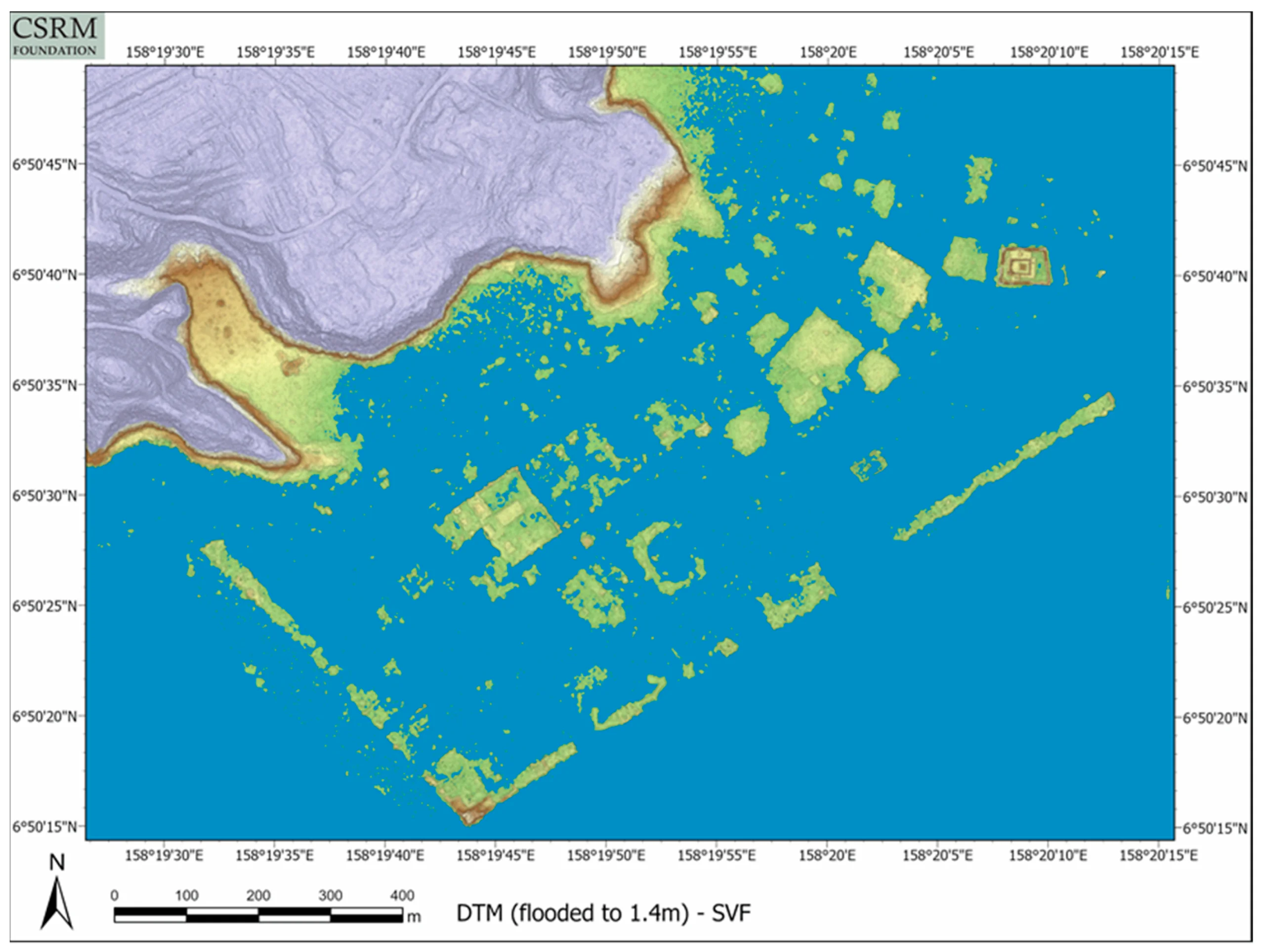
The same elevation models that reveal the cultivation landscape also quantify threats to Nan Madol. Islets along the southwest–northeast axis stand higher and retain greater structural integrity than those nearer shore or farther seaward; many show clear erosion from tidal cycles and storm surges. An inundation simulation set to 1.4 meters above mean sea level illustrates the extent of low-lying terrain that would flood under elevated sea levels.
Canopy-height rasters identify individual trees exceeding 17 meters that risk damaging structures. Flow models indicate that the Temwen network currently channels runoff into Nan Madol’s canals, contributing to siltation and mangrove encroachment. Targeted vegetation clearance and selective restoration of channels could increase water flow through the canals, reducing silt without wholesale removal of protective mangroves.
Regional Comparisons and Research Directions
The plan of basins, channels, and berms on Temwen resembles the complex pondfield systems of New Caledonia associated with the Traditional Kanak Cultural Complex and certain Polynesian terrace systems such as the Kohala field system on Hawai‘i. Retaining walls elsewhere on Pohnpei are typically rock-faced; the almost entirely earthen character of the Temwen features is therefore distinctive and may reflect the scarcity of surface stone on the island.
Soil sampling, pollen, phytolith, and plant-macroremain analyses will be required to identify specific crops and confirm the chronology relative to Nan Madol’s construction phases. Comparative work on other Pacific high islands may clarify whether the system originated locally or reflects wider exchange networks that also moved pottery traditions and plant cultivars.
In Conclusion
The 2019 LiDAR survey transformed the archaeological picture of Nan Madol by exposing an adjacent landscape of engineered basins, berms, and channels whose labor demands rival those of the stone islets themselves. The system could have generated substantial surpluses for daily consumption, feasting, redistribution, or inter-island exchange, thereby underwriting the regional influence of the Saudeleur Dynasty.
The same data set supplies precise elevation and vegetation products that guide stabilization, silt management, and interpretation planning for the World Heritage Site. Further dating, paleobotanical analysis, and comparative surveys will determine the exact relationship between the Temwen cultivation network and the rise of Nan Madol, refining models of political economy across the Central and Eastern Caroline Islands.
