

Recent archaeological work in the high mountain zones of the Pyrenees is delivering a quiet but profound shift in how we understand ancient human presence. For decades, these rugged peaks and valleys above 1,500 meters were viewed as marginal at best; places where people might have passed through briefly during conflict or for specialized tasks, but never truly settled or used intensively. New data from multiple projects now converge on a different picture. Humans were not only present earlier than expected but maintained lengthy continuity in some of the most demanding environments in Europe. Three key studies, spanning broad synthesis and fresh excavation results, build a compelling consensus that forces us to reconsider what we assume about the “empty” extremes of the ancient world.
The Radiocarbon Backbone
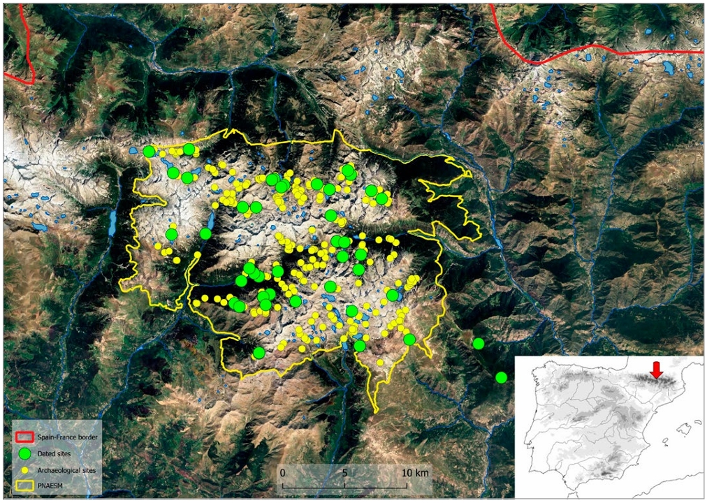
One cornerstone comes from a comprehensive 2026 analysis of radiocarbon dates across the Aigüestortes i Estany de Sant Maurici National Park and surrounding areas in the southern central Pyrenees. Researchers compiled 124 absolute dates from 45 sites, drawn from rock shelters, open air architectural remains, and a smaller number of combustion structures linked to early metallurgical activity.
The sequence stretches across nearly the entire Holocene. The earliest reliable signals appear around 8700 to 7600 cal BC in the oldest layers at sites such as the Dolmen de la Font dels Coms area and Abric de Les Obagues de Ratera. From that point forward, human presence shows notable continuity, punctuated by fluctuations in intensity rather than outright abandonment.
Statistical modeling of the dates, including summed probability distributions with binning to account for sampling differences, reveals periods of stronger and weaker signals. Most dated contexts tie to livestock related architecture: clusters of huts and enclosures that represent roughly two thirds of the recorded sites. Rock shelters and caves account for another significant share, while stone circles, charcoal kilns, and furnaces appear in smaller numbers. Sites cluster between roughly 2,170 and 2,380 meters in elevation on average, often near water sources and grassland zones ideal for herding.
This body of dates provides the chronological spine for understanding how human activity expanded, contracted, and persisted in a landscape long thought too severe for anything beyond fleeting visits.
Earliest Footprints
A broader 2017 synthesis places these early dates into a longer arc stretching back to the late Pleistocene. While solid evidence inside the high mountains remains sparse before the Holocene, the transition after the Younger Dryas marks a clear upward movement.
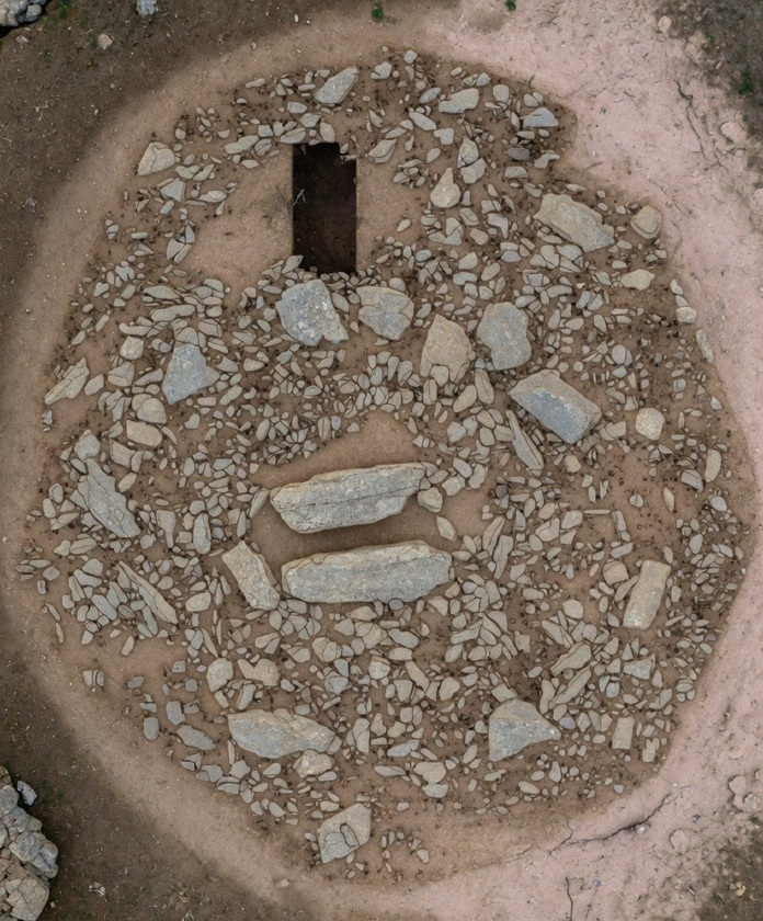
By approximately 8700 cal BC, people were already operating at elevations around 1,840 meters, as shown by a post hole beneath a later megalithic mound at the Dolmen de la Font dels Coms site. Charcoal from that feature yielded one of the oldest determinations in the region.
Slightly later, around 7000 cal BC, a hearth inside a small rock shelter at 2,430 meters (Abric de l’Estany de la Coveta I) contained pine charcoal and a handful of small lithic tools, including a scraper linked to hide processing.
These are not isolated anomalies. Comparable early Holocene signals appear in nearby valleys in Andorra and other sectors of the axial Pyrenees. The picture that emerges is one of mobile groups gradually incorporating higher terrain into their seasonal rounds as climates warmed and glaciers retreated. What was once assumed to be empty or only marginally used space was, in reality, part of a widening human landscape from the very beginning of the Holocene.
Neolithic Arrival
The arrival of Neolithic practices brought further transformation. Domestic animals and plants appear in Pyrenean contexts by roughly 5500 cal BC, with some sites showing mixed foraging and early herding economies. While the initial wave may have been patchy, the data point to relatively rapid integration rather than long isolation.
A decisive expansion occurs after 3500 to 3300 cal BC. The number of documented sites above the modern timberline rises sharply. This uptick coincides with clearer signs of anthropogenic impact in sedimentary records and aligns with the spread of mobile herding practices across alpine and subalpine zones.
The 2017 synthesis and the 2026 radiocarbon compilation both highlight this phase as a threshold moment. What had been intermittent presence evolved into more regular, structured use of high mountain pastures. Enclosures, huts, and associated features multiplied, suggesting that herding communities had woven these extreme elevations into the fabric of their yearly cycles. The Pyrenees were no longer a barrier or a last resort; they had become an active part of a broader territorial system.
Sustained Intensity Above 2,000 Meters
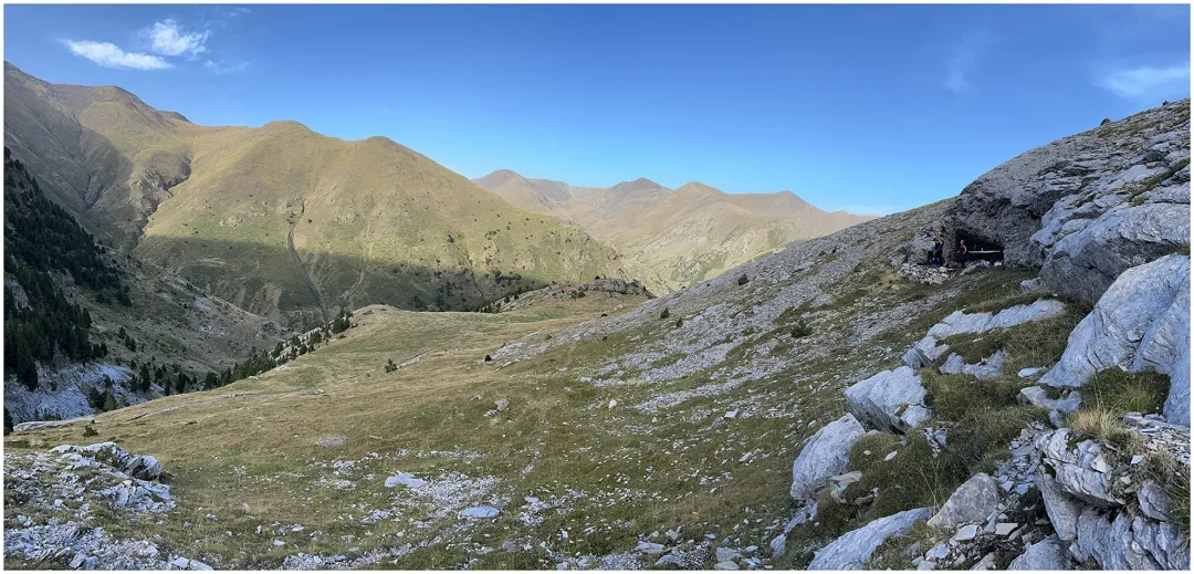
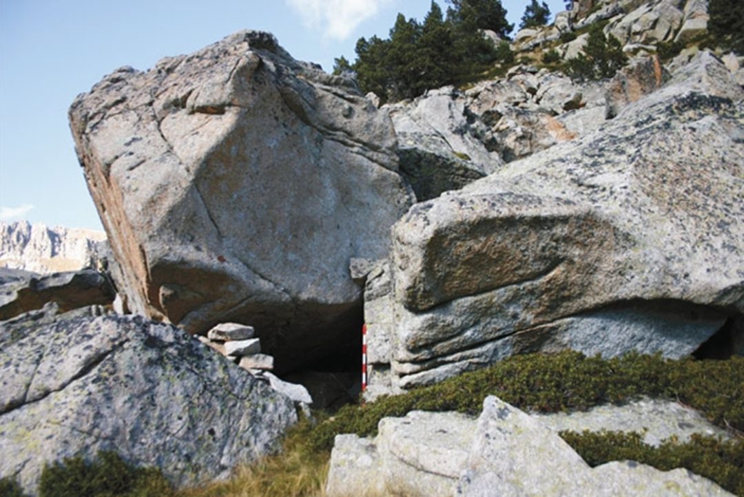
The most striking challenge to older assumptions comes from a 2026 excavation report on Cave 338, located at 2,235 meters in the eastern Pyrenees within the Freser Valley system. This karstic cavity, tested earlier but systematically excavated between 2021 and 2023, preserves one of the highest altitude prehistoric cave sequences with repeated occupation currently documented anywhere in the range. Radiocarbon results establish recurrent use beginning in the early fifth millennium cal BC and continuing, with intervals of reduced activity, into later prehistoric periods.
The stratigraphic record is dense and well preserved. Archaeologists uncovered numerous combustion features, abundant processed faunal remains (primarily sheep and goat), ceramic fragments, and lithic material. Most remarkably, the site yielded repeated introductions of green mineral fragments, most likely malachite, a copper rich ore.
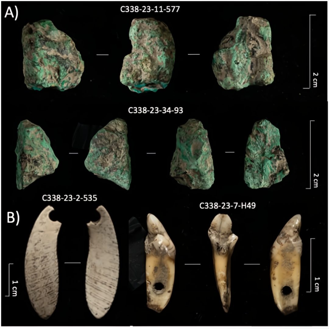
These were brought into the cave and processed on site across multiple phases.
This is not the signature of brief, low intensity stops. The organization of space, the density of hearths and pits, the consistent processing of both animals and minerals, and the sheer longevity of the sequence all point to a logistical node within structured seasonal mobility. Cave 338 functioned as a repeatedly occupied base for activities that included resource extraction and preparation in an alpine setting.
The site sits well above 2,000 meters and demonstrates that such elevations could support sustained, purposeful presence rather than only ephemeral or marginal use. Earlier models that characterized high mountain occupations as short lived and low impact no longer fit the evidence emerging from this and related contexts.
Rethinking What We Assume
Taken together, the three studies create a coherent revision. The Pyrenees were occupied earlier than many expected, with continuity stretching from the early Holocene through the Neolithic and into the Bronze Age. High elevations hosted not only passing hunters but herding communities and, at least in some locations, specialized logistical activities such as mineral processing. The intensity and repetition visible at sites like Cave 338, combined with the statistical weight of dozens of dates across dozens of locations, dismantle the notion that these zones were peripheral voids.
This matters far beyond one mountain range. Across the globe, archaeologists have often defaulted to the view that the most extreme environments, high mountains, arid interiors, polar margins, were last to be explored and least likely to hold complex or sustained ancient activity. The Pyrenees data invite a wider reevaluation. If well stratified sequences, repeated combustion features, and specialized resource use can appear above 2,200 meters in the European Alps’ western extension, what comparable signals might await discovery in other “empty” extremes once systematic work reaches them?
Introspective
The findings also raise a subtler provocation. The level of organization required to maintain seasonal rounds that regularly incorporated such altitudes, to process minerals on site, and to leave detectable archaeological footprints across millennia suggests social and logistical capacities that older narratives of simple, marginal foragers did not fully anticipate. While this does not equate to evidence of an advanced urban civilization hidden in the peaks, it does open space for considering that some chapters of ancient human presence in the peripheries were more structured, more persistent, and perhaps more consequential than we have allowed ourselves to imagine. In that sense, these discoveries echo the spirit of “lost civilization” questions, not by supplying Atlantis in the Pyrenees, but by showing how much of the ancient world we may still have overlooked simply because we assumed certain places were always empty.
Conclusion
The Pyrenees revelation is ultimately a call to look harder and with fewer preconceptions. The oldest dates, the highest elevation sequences, and the demonstrated continuity across thousands of years all converge on one message: ancient humans were far more capable of engaging with extreme environments than traditional models granted. What we once labeled marginal or void may instead have been integral, strategic, and, in places, surprisingly busy. The peripheries, it turns out, have much to teach us about the center of the human story.